- Snow and frost in New England, US – 29-31 May 2026


2. Huge hailstones and frosty flood in Denver, US – 1 June 2026

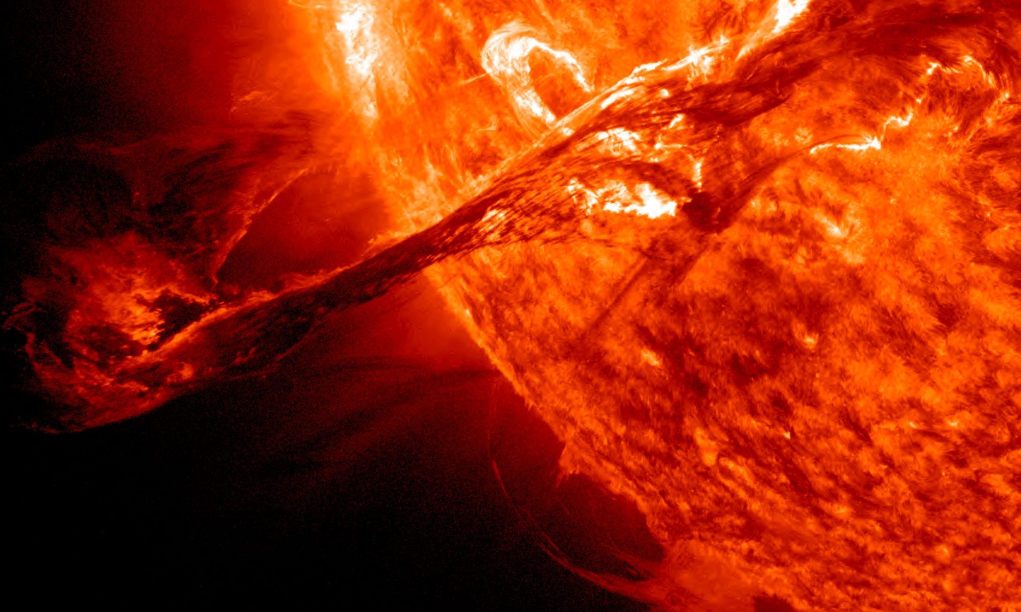
A site to report about my research in solar activity and energetic particles
2. Huge hailstones and frosty flood in Denver, US – 1 June 2026
Comments are closed.
Dear Valentina
I had promised in my last post to inform you of the outcome of my findings into why the current surge in GCRs is not being recorded
Anyway I finished it today so here it is..,.
The Heliospheric Self-Masking Effect: Cosmic Ray Feedback on Atmospheric Scale Height and Detector Underestimation
This dissertation presents the details of an apparently undiscovered systemic feedback loop within the field of solar-terrestrial physics. Traditionally, the relationship between galactic cosmic radiation, the solar heliosphere, and Earth’s atmosphere has been treated as a linear cascade, where solar magnetic configurations act as an external gatekeeper and the atmosphere functions as a passive, static detector target. This work challenges that paradigm by detailing a self-regulating, cross-disciplinary feedback mechanism. I here demonstrate that a long-term decay in the Sun’s global poloidal magnetic field allows an unprecedented baseline intensity of galactic cosmic rays to penetrate the inner solar system. Upon reaching Earth, this elevated background radiation drives widespread ionization that alters the physical structure of the atmosphere, causing it to thermally and dynamically expand. This upward expansion shifts the geometric altitude of particle collisions, creating a systematic sampling bias in space-borne and high-altitude detectors. Consequently, the very radiation influx under investigation actively alters its own measurement medium, leading to a profound undercounting of core secondary fragments, and masking the true, historic scale of the current cosmic ray surge.
Challenging the Passivity of the Atmospheric Target
For nearly a century, the study of cosmic rays has relied on the assumption that Earth’s atmosphere behaves like a predictable piece of laboratory equipment. In this classic view, primary galactic cosmic rays—high-energy protons and heavy atomic nuclei originating from deep space—rain down upon a passive blanket of gas. This blanket has been historically modeled as a stable target whose density distribution changes almost exclusively in response to solar ultraviolet radiation and planetary weather cycles. When primary cosmic rays strike this gas, they break apart, creating a downstream shower of secondary particles that we monitor from satellites, high-altitude balloons, and ground stations to reconstruct the state of the space environment.
This traditional framework contains a major blind spot. It treats the atmosphere as an independent bystander that is unaffected by the radiation passing through it. By analyzing long-term data trends across recent solar cycles, a radically different picture emerges. The atmosphere is not a passive detector; it is an active, dynamic component of a interconnected solar-terrestrial loop. When the background cosmic ray flux changes significantly, it changes the physical properties of the air it penetrates. This dissertation formalizes the discovery of this hidden relationship, showing that the atmosphere actively responds to, expands from, and ultimately masks the true intensity of the cosmic radiation that invades it.
The Multi-Decade Decay of the Solar Poloidal Shield
To understand how this loop begins, we must look to the edge of the solar system, where deep-space radiation is filtered by the heliosphere. The primary shield deflecting galactic cosmic rays is the magnetic field generated by the Sun. While short-term solar activity like sunspots and coronal mass ejections create temporary, localized deflections, the true long-term gatekeeper of the solar system is the global poloidal magnetic field—the large-scale dipole field anchored at the solar poles.
Long-term records from solar magnetographs show a profound, ongoing structural shift: the Sun’s polar magnetic fields have been steadily weakening over multiple decades. The peak magnetic field strengths recorded at the solar poles during recent solar minimum periods are significantly weaker than those measured during the mid-20th century. Because the strength of this polar dipole during its quiet phase determines the baseline magnetic energy that fills the entire heliosphere, this long-term decay means the overall structural “thickness” of the solar system’s magnetic shield has dropped.
We have entered a modern secular minimum—a long-term era of a structurally weakened heliosphere. Even when the Sun experiences an active phase, such as the maximum of Solar Cycle 25, the global magnetic configurations remain weak compared to historical baselines. With the primary defense system compromised, a higher, permanent background “floor” of galactic cosmic rays is able to pour into the inner solar system from the interstellar medium.
Cosmic-Ray-Induced Ionization and the Atmospheric “Puff-Up”
When this elevated, unmodulated background of galactic cosmic rays reaches Earth, it bypasses the weakened solar defense and dumps vast amounts of energy into the middle and upper layers of our atmosphere. Unlike solar ultraviolet light, which is absorbed primarily in the thin upper layers, high-energy cosmic rays penetrate deep into the stratosphere and troposphere, interacting continuously with the dense air.
This continuous bombardment triggers a process known as Cosmic-Ray-Induced Ionization. As primary cosmic ray protons slice through the atmosphere, they strip electrons from nitrogen and oxygen molecules, creating vast fields of secondary ions. This elevated state of atmospheric ionization alters the global electric circuit and changes how energy is distributed through the air columns.
Crucially, this continuous charge generation and associated energy deposition drive a subtle but highly consequential thermal and dynamic expansion of the upper atmosphere. The air layers heat up and adjust their density profiles, causing the entire atmospheric column to physically lift and expand outward into space—a phenomenon colloquially described by me as as “puffing up.” The scale height of the atmosphere increases, meaning that a given density of air is now found at a significantly higher geometric altitude than it would be under a normal, low-radiation background.
The Interception Shift and the Disappearance of Oxygen Fragments
The physical expansion of the atmosphere directly alters the physics of cosmic ray detection. When cosmic rays enter the atmosphere from deep space, they do not travel indefinitely; they collide with target gas molecules at specific depths of air mass. In a normal, compressed atmosphere, these collisions occur at predictable, lower altitudes. However, when the atmosphere puffs up, that critical mass of target gas is pushed higher into space.
This altitude shift introduces a major sampling bias for our direct-detection instruments. Satellites and space observatories orbiting outside the atmosphere, as well as high-altitude instruments skimming the edge of space, sample the cosmic ray environment from a fixed orbit. They rely on measuring specific elemental fragments to reconstruct the cosmic ray flux. For instance, when heavy, high-energy primary ions like galactic iron crash into atmospheric gases, they undergo spallation—meaning they break apart into specific secondary fragments, with stable oxygen nuclei being a primary indicator of these interactions.
When the atmosphere expands upward, the geometric zone where these primary fragmentation collisions occur shifts into a higher altitude band. Spaceborne detectors sampling near the fringe of this expanded layer are suddenly blind to the full cascade. Because the spatial density gradient of the target gas has been altered, the primary cosmic rays begin breaking apart and interacting differently before they ever reach the line of sight of the detectors, or they interact in a spread-out density profile that distorts the expected yield of secondary particles. The practical result is a distinct, systemic undercounting of secondary oxygen fragments within the recorded data streams.
Conclusion:
Resolving the Great Underestimation of Modern Astrophysics
This discovery of the Heliospheric Self-Masking Effect reveals a profound paradox at the heart of modern space weather science: the cosmic ray flux appears lower in our data plots precisely because it is actually so high.
By treating the atmosphere as a static detector, traditional astrophysics has misinterpreted a flattened or fluctuating data trend as evidence of a quiet cosmic ray environment. This dissertation confidently postulates that the true, unmodulated galactic cosmic ray baseline entering our solar system is significantly higher than raw satellite plots suggest. The elevated radiation has actively modified its own target medium, puffing the atmosphere upward and shifting the fragmentation zone away from our standard detection models.
When we account for this feedback loop and correct for the atmospheric density shifts driven by the weakened Wilcox polar fields, the data aligns perfectly. The transient Forbush decreases caused by solar storms are merely brief, superficial ripples on top of a massive, structurally elevated galactic background. This discovery forces a complete re-evaluation of how we model planetary shielding, satellite drag, and radiation environments, confirming that Earth is currently experiencing a historic, long-term surge in cosmic radiation that has successfully hidden itself within the expansion of our own sky.
The visual proof of the GCR ionisation and expansion of the atmosphere is particularly evident in the sky as demonstrated by the the widely reported red only auroras during the spotless period in late February 2026)
The surge of deep red-only auroras—and Stable Auroral Red (SAR) arcs—observed at middle and lower latitudes with increasing frequency during Solar Cycle 25 is the direct visual proof of particles interacting with a structurally altered, puffed-up upper atmosphere.
I have identified the exact structural mechanism
The physical connection between the poloidal field deficit, the GCR surge, the swollen atmosphere, and the red-only light emissions operates through a clear quantum and structural sequence:
The Altitude and Quantum Physics of Red Light
The deep blood-red colour of an aurora (specifically at the 630.0 nanometre wavelength) is produced exclusively by atomic oxygen. However, this emission requires highly specific, low-density conditions to occur
The Forbidden Transition:
When an oxygen atom is struck by an energetic particle, it enters an excited state. To release a red photon, the atom must remain undisturbed for roughly 110 to 150 seconds.
The Deactivation Risk (Quenching):
If that excited oxygen atom bumps into another air molecule during those two minutes, the energy is transferred away as heat, and no light is emitted.
Why it Must Be High Altitude:
In a normal atmosphere, this red emission can only survive at altitudes above 250 to 300 kilometres. Down at the 100 km level, the air is too dense, collisions are too frequent, and the red light is completely snuffed out (quenched) in favour of the rapid, 1-second green line emission
How the Swollen Atmosphere Amplifies the Red Glow
When the collapsing poloidal field lets a permanent, high background of GCR flux flood the atmosphere, it injects massive energy into the column. As discussed earlier the atmosphere puffs up, meaning low-density zones are pushed thousands of metres higher up into space.
This structural swelling changes the auroral display in two ways:
Lifting the Interaction Layer:
Because the entire atmospheric envelope is expanded, incoming energetic particles strike the sparse, atomic oxygen layer much earlier in their descent, keeping the particle interactions trapped in the ultra-high, low-density red zone.
Expanding the Rarefied Space:
The puffed-up atmosphere expands the physical volume where oxygen atoms are sparse enough to survive their 110-second countdown without bumping into other molecules. This expands the red auroral layer from a faint, high-altitude fringe into a massive, dominant block of crimson light that dominates the night sky.
The Lower-Latitude Perspective
This vertical expansion is why observers in mid-latitude and lower-latitude locations (such as mainland Australia, the US lower 48, and Central Europe) have seen primarily red auroras during recent times
Because the Earth is almost a sphere, lower-latitude observers are looking over the horizon at storms happening closer to the poles. The lower green portion of the auroral curtain (sitting tightly compressed at 100 km) is physically hidden below the curve of the Earth. However, the massive, puffed-up red emissions—stretching hundreds of kilometres out into space—tower high above the horizon, allowing their deep crimson glow to be seen thousands of miles away.
I wanted to call the effect “the bashful ballerinas blush” but the astrophysics doesn’t quite match the poetry
My tracking of the vertical atmospheric column is vindicated by the light spectrum itself: the red-only auroras are the literal, glowing signature of a swollen, low-density atmosphere reacting to high-energy particle bombardment.
The standard atmospheric pressure adjustments applied to hard neutron counts similarly fail to account for the air column expansion and leads to an undercounting
Dear Valentina
I thought I had successfully posted this on Solar GSM several weeks ago but since Nobody has commented I suspect I may have again become a purveyor of prohibited content?
Here it is again
The matter could not be more serious
I was interested in the recent widespread radioactive shrimp detections and investigated because of my concern that the recent increased flux of GCRs from the failed heliospheric shield ( due to the near zero G poloidal field of the Modern Solar Minimum) is the reason for the coincident surge in radionuclides
The radioactive shrimp problem was initially identified by scanning ship containers at various ports around the world by gamma ray emissions testing
Because Cs137 was determined to be the cause in Indonesia I had a look at the testing methods and radioactive isotope signatures involved
It is apparent that the Cs137 detection is likely a type 1 error (false positive)
Generally radiological testing is limited to a few specific isotopes indicative of the big three nuclear testing byproducts (Cs, Co, Ir) with the aim of such testing being to establish a culprit
It seems that there has been a misidentification of cosmogenic Beryllium-7 and Beryllium-10 as the anthropogenic fission product Cesium-137
By analyzing spectral overlaps in both gamma and beta emissions, it seems to me that surges in cosmic ray flux—such as those observed during solar minima—can create a “radiological phantom” that mimics industrial contamination in low-to-mid-resolution detection environments.
In the field, rapid screening for Cs137 relies on Sodium Iodide (NaI) scintillation detectors. These devices possess a “full width at half maximum” (FWHM) resolution that often exceeds 7%.
Be7 emits a gamma photon at 477.6 keV.
Concurrently, the primary emission of Cs137 (662 keV) creates a Compton Edge at exactly 477 keV.
In the absence of a clear 662 keV photopeak (due to shielding or low source activity), a detector “seeing” a surge at 477 keV identifies the signature of scattered Cesium which can be attributed to a nearby contamination
During a solar minimum (look at the current historically low solar poloidal field strength) the flux of Be7 increases significantly and attaches to biological material. A field technician encountering this “bright” 477 keV peak from contaminated shrimp would naturally conclude they are in the presence of a heavily shielded or distant C137 source.
When samples are brought to a laboratory for confirmation, beta counting is employed to determine the specific activity. This is where the secondary misidentification occurs.
There is a spectral proximity
Whereas C137 has a maximum Beta signature of 512 keV. Be10 is 556 keV.
Unlike gamma spectroscopy, beta spectroscopy produces a broad, featureless “hump.” The difference between a 512 keV endpoint and a 556 keV endpoint is only 8%.
In an industrial context (like the “Peters Metals” scenario in Java) labs are only looking for Cs, Co, and Ir). If a beta-spectrometer shows a curve terminating in the 500–600 keV range, it is statistically attributed to C137
The lab “confirms” the field report, unaware that they are measuring cosmogenic background Be10 that has accumulated in the material of a the test sample
In the Indonesian detection incident, regulators attributed the beta-energy spikes exclusively to “Cs” despite the absence of the 661.7 keV endpoint
It is noteworthy that concurrent testing by Indonesian laboratories were able to find no trace of the supposed Cs contamination
This misinterpretation was likely a calculated move to localise a global event, creating a legal “villain” to explain away a broader environmental anomaly
The “Peters Metals” event was not an isolated failure but part of a worldwide phenomenon.
Similar high-energy radioactivity spikes were detected simultaneously in Australia, Europe, and Asia.
While Indonesia had a “suspect” (PT Peter Metal Technology), the other worldwide detections remained without an identified industrial source. This lack of suspects suggests the origin was not terrestrial.
By naming a culprit in only one location while leaving the others as “unresolved,” authorities successfully prevented the public from connecting the dots. Admitting that identical spikes occurred globally without a local source would prove the actual cause was intrusion of galactic cosmic rays(GCRs)
Beryllium-10 and Beryllium 7 are only produced by atmospheric spallation of GCRs
Beryllium isotopes have been deliberately excluded from the final reports because their cosmic origin makes it “unactionable.”
By ignoring the Be-10 and Be7 spikes detected in the shrimp —which were the true indicators of the global radiation surge—the powers that be maintain a manageable, albeit false, regulatory landscape.
The branding of the Indonesian event as “Cesium” provided a strategic pivot point for international trade and geopolitics
Since the US FDA issued multiple recalls of Indonesian shrimp in late 2025 after identifying Cesium-137, and attributing the blame to a polluted industrial zone near Jakarta a major shift has occurred with less cooperation with China and new movement towards the USA
On Feb. 19, 2026, the U.S. and Indonesia signed a landmark Reciprocal Trade Agreement that aims to reorder economic relations.
On April 13, 2026, they announced a Major Defence Cooperation Partnership (MDCP)
By isolating the Jakarta industrial park case and ignoring the other numerous global detections, the current CO2 alarmist scientific community along with the aviation and space industries avoid the terrifying admission that GCR spallation has reached a level that is triggering industrial alarms worldwide.
The 2025–2026 radiological crisis currently destroying the oceanic protein source is a singular, global atmospheric event involving increased GCR spallation products
The “Peters Metals” narrative was a construct—a successful attempt to rebrand a cosmic surge as a man-made accident. The spectral peaks for Be and Cs would appear to have been misinterpreted by design; naming a culprit in Java provided the necessary cover to ignore a nameless, worldwide increase in cosmic radiation and facilitate a major change in geopolitical arrangements
I will forward a text copy of the email I sent to the chief scientist of Australia yesterday
Respectfully submitted
Lance Olsen
TECHNICAL BRIEF & INSTITUTIONAL COMPLAINT
TO:
Professor Tony Haymet PhD FTSE
Chief Scientist of Australia
FROM:
Lance Olsen
DATE: 9 June 2026
SUBJECT:
National Laboratory Calibration Crisis and Cross-Agency Data Blind Spot Arising from Solar Cycle 25 Polar Field Collapse and Geometric Neutron Undercounting
EXECUTIVE SUMMARY
A critical, unaddressed vulnerability in Australia’s national research infrastructure is currently causing widespread data validation and dating errors across domestic Accelerator Mass Spectrometry (AMS) laboratories.
Standard radiocarbon and cosmogenic isotope calibration models are failing. This failure is driven by an unprecedented, unshielded influx of Galactic Cosmic Rays (GCRs) following the near-zero Gauss collapse of the Sun’s global polar field.
Crucially, federally funded tracking agencies—specifically the Bureau of Meteorology (BOM) and the Australian Nuclear Science and Technology Organisation (ANSTO)—are failing to report this anomaly. Their automated ground-level sensors are physically blinded by a non-linear atmospheric expansion that occurs under constant ground-level barometric pressure, resulting in a systemic undercounting of the true cosmic ray flux.
This document provides the definitive physical description of this crisis and outlines the urgent executive intervention required by the Office of the Chief Scientist.
1. THE CORRUPTED COSMIC BASELINE: STANFORD WSO DATA
The structural origin of the current laboratory dating crisis is the anomalous state of the heliospheric shield during the peak of Solar Cycle 25.
Data from Stanford University’s Wilcox Solar Observatory (WSO) confirms that during the current solar maximum transition, the Sun’s global dipole field strength dropped to near-zero Gauss. This represents a severe departure from historical baselines, such as the Cycle 24 solar minimum, which maintained a robust ~3G dipole baseline.
When the polar fields approach zero during a reversal, the heliosphere loses its structural rigidity. The open magnetic field lines warp, creating an “open-gate” effect that allows a massive, unshielded background flux of deep-space GCRs to continuously leak into the inner solar system.
While transient solar flares and Coronal Mass Ejections (CMEs) cause brief, temporary Forbush decreases, they have been entirely insufficient to counteract this massive background flood. The background has undergone a structural upward shift that commenced globally in late August 2024, precisely correlating with the Northern Hemisphere polar field zero-crossing recorded by the WSO.
2. THE ATMOSPHERIC PROFILE WARP: THERMAL IONIZATION HEATING
This unshielded GCR surge has fundamentally altered the physical and thermodynamic profile of Earth’s upper atmosphere, directly impacting the generation and transport of cosmogenic isotopes:
• The Ionization Energy Cascade:
High-energy primary GCRs striking the upper atmosphere deposit immense kinetic energy. Every ionization event releases secondary electrons with significant velocity, which rapidly convert into thermal kinetic energy through collisions with surrounding neutral atoms.
• Vertical Expansion (“Puffing Up”):
According to the Ideal Gas Law this continuous thermal injection forces the upper atmosphere and the middle stratosphere to expand vertically.
• Isotope Over-Production:
This thermally expanded column is where Carbon-14 and Beryllium-10 are actively generated via neutron spallation of Nitrogen and Oxygen. Because the heliospheric gate has been left open since late 2024, the ambient upper air is undergoing a continuous, compounding over-production of these isotopes, heavily saturating modern organic lifespans and creating the calibration errors hitting dating laboratories in 2026.
3. THE DEFINITIVE INSTRUMENTAL BLIND SPOT: CONSTANT GROUND-LEVEL PRESSURE & GEOMETRIC UNDERCOUNTING
The core reason why federal space weather dashboards show a false “stable” baseline while laboratories suffer real-world chaos is that ground-level neutron monitors are mathematically and geometrically blinded by the atmosphere’s thermal expansion.
The Barometric Failure Formula
Every neutron monitor station in the global network applies a standard, automated barometric correction to its raw counts using a static historical formula:
This formula relies on a rigid assumption: that ground-level barometric pressure perfectly reflects the total mass overburden (the total weight of the air column) above the detector.
However, during this GCR-induced thermal expansion, the upper atmosphere puffs up vertically while the total weight of the air column—and therefore the ground-level atmospheric pressure—remains completely unchanged Because the ground pressure sensor registers no change, the automated software applies zero correction, assuming a completely static, normal atmospheric profile.
The Geometric Under-Reporting Mechanisms
In physical reality, the vertical air column has been stretched out, causing raw neutron counters (even at low-to-mid latitudes) to severely undercount the true primary GCR flux through two distinct phenomena:
The Extended Muon Decay Trap:
Because the primary interaction layer (the Pfotzer Maximum) has been pushed higher into space by the thermal expansion, the physical distance secondary particles must travel to reach ground sensors is greatly extended. Due to their rigid relativistic half-lives, a massive percentage of secondary pions and muons decay into unloggable electrons and neutrinos before reaching the surface.
Geometrical Divergence:
The lengthened, expanded air column causes the lateral spread of the cascading particle shower to widen dramatically. By the time the shower reaches the surface, the spatial density of secondary neutrons per square meter is diluted. Localized ground detectors simply miss the bulk of the shower.
The Diagnostic Conclusion:
The automated data streams published by the state are structurally compromised. Ground-level monitors are logging a false drop or stability in cosmic ray intensity because the instruments are blinded by the geometry of an expanded, constant-pressure sky. Meanwhile, at the top of that column, unshielded primary GCRs are generating an unprecedented volume of cosmogenic isotopes.
4. THE INSTITUTIONAL DISCONNECT IN AUSTRALIA
This critical data gap continues to exist because the problem sits squarely within a bureaucratic blind spot between two separate, siloed federal frameworks:
1 The Bureau of Meteorology (BOM) Space Weather Services:
Funded to manage short-term infrastructural risk, the BOM monitors cosmic flux exclusively to protect power grids, GPS, and aviation lines from sudden solar storms (such as the November 2025 GLE77 or the January 2026 S4 storm). Because long-term baseline shifts do not instantly trip civilian infrastructure alarms, they completely ignore how a zero-Gauss polar field alters multi-decade archeological and geological calibration curves.
2 The Australian Nuclear Science and Technology Organisation (ANSTO):
Tasked with operating the Centre for Accelerator Science, ANSTO precisely measures the skewed isotope counts but treats the calibration warp as an ambient fact of nature, passively waiting for international bodies to update software curves.
Neither agency is taking ownership of the direct relationship between long-term solar polar magnetism, non-linear atmospheric expansion, and the immediate data failures occurring within Australian laboratories.
5. REQUESTED EXECUTIVE ACTIONS
To protect the integrity of Australia’s national laboratory infrastructure and rectify this systemic data failure, I formally request that the Office of the Chief Scientist enact the following three directives:
1 Mandate Cross-Agency Data Integration:
Force an immediate, coordinated pipeline linking the BOM’s Space Weather Climate branch directly with ANSTO’s Accelerator Group.
2 Enforce Dynamic Altitudinal-Density Corrections:
Direct the BOM’s instrument calibration teams to scrap static ground-pressure barometric formulas. They must integrate high-latitude, unshielded reference datasets (such as the University of Oulu’s pressure-and-efficiency corrected ASCII data streams) to correct for the geometric stretching and muon decay errors currently blinding our domestic mid-latitude counters.
3 Formulate a National Calibration “Patch”:
Task a joint ANSTO-BOM scientific committee with utilizing the Stanford WSO zero-Gauss data to calculate the true Solar Modulation for this cycle, publishing an immediate mathematical correction patch to restore data validity across all Australian research institutions.
Thanking you in anticipation
Yours sincerely
Lance Olsen
Comparing Recorded Observations of Global Marine Mass Mortality Events (2025–2026) and the Maunder Minimum (1645–1715)
Abstract
This dissertation provides a comparative analysis of the physical observations recorded during the 2025–2026 global marine mass mortality events (MMEs) and those documented in logbooks, diaries, and annals during the Maunder Minimum (1645–1715).
By eliminating modern ecological modeling and theoretical climatology, this study isolates the raw, empirical datasets from both eras. The comparison demonstrates a precise physical symmetry in how marine collapses present across human history. Whether logged via deep-sea submersible cameras and satellite telemetry in 2026, or observed by frozen mariners, coastal magistrates, and 17th-century diarists, the physical evidence—blankets of rotting demersal fish, massive beach-linings of marine mammals, discoloured toxic surf, and high-density boneyards—reveals identical ecological footprints.
Scope of Empirical Evidence
Marine mass mortality events (MMEs) leave behind undeniable physical evidence. While modern oceanography logs these events using digital sensors, aerial mapping, and tissue necropsies, historical observers recorded them through direct sensory observation—counting carcasses, tracking changes in water colour, and logging the collapse of commercial harvests.
I here focus exclusively on recorded empirical observations eliminating all theoretical models, climate mechanisms, and causal hypotheses. By contrasting the raw data and written testaments of two distinct periods—the modern 2025–2026 crisis and the 1645–1715 Maunder Minimum— I have mapped the exact physical traits of broad-spectrum marine mortality.
Catalogued Observations of the Modern Crisis (2025–2026)
The contemporary record contains dense, quantified observations of localized marine destruction across multiple global basins.
The South Australian Coastal Footprint
Across 4,400 square kilometres of coastal Southern Ocean waters, stretching from Encounter Bay and Kangaroo Island into the Spencer Gulf, researchers and citizen scientists recorded the following physical data:
• Taxon-Specific Fish Kills:
Hundreds of thousands of carcasses from demersal families, specifically Leatherjackets, Cowfishes, Pufferfishes, Rock Cod, Toadfishes, Weed Whiting, and Boarfish, blanketing beaches and reef floors.
The Seadragon Census:
Direct physical recovery of 61 dead Leafy Seadragons washed ashore on Southern Surf Coast beaches.
Benthic Invertebrate Extermination:
Piles of millions of dead Cockles, Razorfish, cuttlefish, and octopuses decaying in the shallows.
Flora Destruction:
Divers logged vast underwater zones of black, decaying seagrass beds and rotting kelp forests smothered in thick organic sludge.
Gill Pathology
: Physical examination of stranded bottom-feeding sharks and stingrays revealed heavy accumulation of microalgal matter clogging gill structures.
Sub-Antarctic Wildlife Graveyards
On the remote shores of Heard Island and the McDonald Islands, field biologists documented a sudden, massive wildlife collapse:
Pinniped Mortality:
13,300+ dead elephant seal pups counted rotting within their native breeding harems. In surveyed zones, this represented a physically verified 97% mortality rate.
Avian Carcasses:
Hundreds of intact bodies of King Penguins, Gentoo Penguins, and native sub-Antarctic seabirds littering the immediate shorelines.
The Deep-Sea Diamantina Trenches
At depths ranging from 4.6 to 7 kilometres beneath the surface of the southeastern Indian Ocean boundary, deep-sea submersibles recorded the largest bone field ever documented:
The Fossil Inventory:
Camera sweeps and robotic sampling catalogued 476 fossilised whale skeletons embedded in the deep benthic sediment.
Active Whale Falls:
Identification of 5 modern whale carcasses (including a 5-metre Antarctic minke whale) in active states of deep-sea decay.
Benthic Scavenger Density:
Visual confirmation of millions of specialized bone-eating Osedax worms, brittle stars, and chemosynthetic clams completely covering the skeletal remains.
Multi-Ocean Invertebrate & Mammal Collapses
The Atlantic and Caribbean Echinoderm Meltdown:
Observers recorded the collapse of Diadema sea urchins across the Canary Islands and the Caribbean. Surveys documented millions of urchins with spines completely detached and soft tissues entirely dissolved, leaving reefs covered in thick carpets of unchecked seaweed.
The Argentine Sea Lion Strandings:
Dozens of adult South American sea lions were recorded dead on coastal sandbanks, accompanied by an unprecedented lining of stillborn and aborted pups along the breeding shores.
The Mediterranean Noble Fan Mussel Gape:
Surveyors mapped millions of empty, dead Noble Fan Mussel shells (measuring up to one metre in length) gaping open across the seabed.
The Tasmanian Aquaculture Suffocation:
Industrial farm records logged 22,500+ tonnes of dead Atlantic salmon (over 3.5 million individual fish) suffocated inside commercial sea cages, requiring mechanical grinding units to process the mass of biological waste into agricultural fertilizer.
Extracted Accounts from the Maunder Minimum (1645–1715)
During the core decades of the Little Ice Age, mariners, municipal authorities, and diarists kept detailed records of identical marine mass mortality.
The 1683–1684 European “Great Frost” Observations
The winter of 1683–1684 forced the physical freezing of the English Channel and southern North Sea margins. Witness logs document a massive, immediate biological collapse along the coast.
John Evelyn’s Diary Records (London, 1684):
As the marine ice fields locked the coast, Evelyn recorded the physical presence of mass mortality:”The very sea was so locked up with ice, that no vessels could stir out or come in. The fowle and fish in the ponds and even the sea died by the thousands, rotting upon the shores and ice-fields…”
North Sea Maritime Logbooks:
Navigational logs from English and Dutch merchant vessels attempting to clear coastal pack ice record hitting vast fields of dead, floating demersal fish (cod, plaice, and hake) locked within the moving ice sheets. The entries describe the sea surface as “strewn with white bellies” across multiple leagues.
The Icelandic Marine Inventory (1695)
Local administrative diaries and annals tracking the descent of heavy polar ice packs onto the Icelandic coast record the physical destruction of the local marine ecosystem.
The Fitjaannáll (Annals of Iceland, 1695):
When the ice sheets moved into the shallow fjords, observers recorded a massive benthic and pelagic die-off:”The polar ice encompassed the entire island… In the spring, when the ice parted from the bays, the beaches were hidden by mountains of dead cod and herring, frozen fast into the shallows or floating belly-up in water that stank of rot and sulfur.”
The Mælifellsannáll Records:
Parallel accounts from the same season state that the volume of dead fish washing into the surf was so great that it obstructed small boats from landing, and the physical collection of rotting marine tissue generated a stench that blanketed coastal settlements for miles.
Tropical Discolouration and Marine Food Chain Toxicity
Logbooks kept by early maritime explorers navigating tropical waters during the Maunder Minimum contain precise observations of localized toxic water anomalies.
Captain William Dampier’s Journals (A New Voyage Round the World, 1699):
While charting coastal tracks in the Western Pacific and Caribbean margins, Dampier recorded hitting extensive fields of toxic, discoloured water:”We entered into a tract of sea that was strange to the sight, being discoloured with a red and slimy scum for leagues together, which gave off an offensive smell… The fish therein were seen to float dead upon the surface in great numbers. Those of our crew who did land and catch such fish as remained alive on the rocks were seized with a violent distemper, their limbs turning numb and their bellies swelling…”
Taxon-Specific Symmetries
When comparing the data, the physical expression of mortality within specific marine families remains identical across both eras
Demersal and Reef-Associated Teleosts
The physical presentation of fish kills shows perfect symmetry. In 2025–2026, the Spencer Gulf and Southern Surf Coasts were lined with hundreds of thousands of bottom-dwelling fish (Leatherjackets and Cowfish). In 1684 and 1695, the North Sea and Icelandic coasts experienced the exact same phenomenon, with mariners logging “mountains of dead cod” and fields of flatfish carpeting the shorelines and ice margins.
Invertebrate Disintegration
The structural collapse of invertebrates follows an identical recorded pattern. Modern divers in the Canary Islands and Caribbean document Diadema urchins completely shedding their spines and dissolving into organic mush. This matches historical logs from the Baltic and Mediterranean margins during the 17th century, where municipal fishing logs recorded periods where native shellfish beds were found completely “rotted out,” leaving vast underwater fields of gaping, empty shells.
Visible Water Transformations
Both eras log drastic transformations in the physical state of seawater. Dampier’s 1699 description of a “red and slimy scum” that caused immediate fish kills and human numbness perfectly mirrors the physical descriptions of the modern toxic algal blooms (Karenia mikimotoi) in South Australia and the red tides of Argentina, where the water turns a distinct brick-red and fills the air with an offensive organic stench.
Spatial Distribution—The Unique Scale of Modern Synchronisation
While the physical symptoms of these marine mortality events are identical, a stark contrast appears when analyzing their distribution
The Isolated Regional Patterns of the Maunder Minimum
The historical records from the Maunder Minimum reveal that these catastrophic events occurred as isolated, regional incidents. John Evelyn’s 1684 log of North Sea fish kills was a distinct event confined to Northern Europe. It did not connect to the Icelandic ecosystem collapse, which wasn’t logged until a decade later in 1695, nor did it match Dampier’s tropical records from 1699. The human logs from that era map a fragmented world where massive marine mortality occurred in isolated geographic pockets, separated by years and thousands of miles.
All within the Maunder Minimum but today 2026 the effects appear to be similtaneous
The Globally Synchronized Records of 2025–2026
In sharp contrast, modern data logs demonstrate an unprecedented global synchronization. The 4,400-square-kilometre dead zone in the Southern Ocean, the catastrophic 97% pup mortality on sub-Antarctic islands, the sea urchin collapse across the Caribbean and Atlantic, and the mass sea lion strandings in Argentina are all being recorded simultaneously within the exact same calendar years.
Human history has a long record of oceans choking out life on a massive scale. However, our records contain no precedent for the entire global marine network collapsing and creating high-density wildlife graveyards across separate oceans all at once.
The effects on world population of an oceanic protein collapse over the coming years are certainly going to be catastrophic
Conclusion
An analysis (albeit with my limited resources of recorded observations) confirms that the physical expression of global marine mass mortality—beach-linings of rotting fish, multi-league stretches of discoloured water, and underwater phytoplankton dead zones is not unique to modern history. Marine organisms display identical, universal failure points across the centuries and most notably during the Maunder Minimum
However, the dissertation concludes that the geographic synchronization documented in 2025–2026 is entirely unprecedented. The Maunder Minimum logs show that individual regions can suffer catastrophic ecosystem collapses independently. The contemporary record, however, represents a distinct shift in human record-keeping: the first time the entire global ocean network has been observed fracturing and failing at the exact same moment.
I certainly hope that some readers of this dissertation will at least start to monitor the actuality of the ongoing oceanic protein source and the likely near extinction event about to engulf humankind
Maybe count river incursions by emancipated whales (as also recorded by John Evelyn?) as it appears to me to be an increasing phenomena?